By Means of the Sole

Last Sunday I had planned on finding a new trail to run in or around Houston, or maybe revisiting one if I had too. As I sat in my living room trying to figure out where to go, I felt unmotivated to drive far, and settled for running the gravel path around Memorial Park. I had run only five other miles in the week because of some funkiness in my knee, but with the issue under control, I wanted to at least get in another hour of running before the week expired. I made two decisions. I would settle for a relatively dull run around the park, but would treat myself to a trip out of town the next weekend for something different.

Fast-forward four days, and you’ve found me writing this from a coffee shop in Austin, Texas. I found a AirBnB in West Austin, taking out a room in a house full of dudes designing an app. I was really excited at the prospect of inserting myself in a “Silicon Valley” type situation, but alas, I have no high-stakes shenanigans to report (yet). What I do have to report is that I went on a delightful trail run not long after arriving, which I’ll report on a paragraph or two down.

On my drive from Houston to Austin, I picked up listening to “The Picture of Dorian Gray”. I started it last September, on my drive from Los Angeles to Houston. It’s a dark choice, but I saw a gorgeous and grotesque artist’s interpretation at the Chicago Art Institute last June and got inspired to read (listen to) Oscar Wilde’s gothic novel. ANYWHO, a character in the novel, Lord Henry, is dependable for accurate yet somewhat depressing descriptions of human behavior and beliefs, and he tells Gray at one point that the senses are a cure for the soul, and the soul a cure for the senses. I mulled this over, as I was driving to the Texas Hill Country to cure something that I was yearning for in my soul- a taste of adventure.

When things suck, for lack of a better word, when life just doesn’t feel right, I throw myself into something that will startle, refresh, or at least be distracting for, my senses. Watch something mindless, eat like its going out of style, or seek out some sort of companionship because being alone is just unbearable. Then there are more rare moments, where nothing is as interesting as what is going on internally, and I’m pushing away all the distractions at once, so I can figure out what is happening in the space between my ears. Unfortunately I think I live more in the former mode than the latter, and I think it would be nice to flip the situation. I’ll never figure the world out, but I think I have a fighting chance of nailing down what really makes me tick someday.

Trail Running often joins those two extremes. Outside, alone on the trails I experience life first hand.  The sensory experience of the world is limited to how I take it in, no memes or sitcoms to interpret human behavior for me. This is how I get closer to answering, “Who am I”? For the record, I still am not sure.

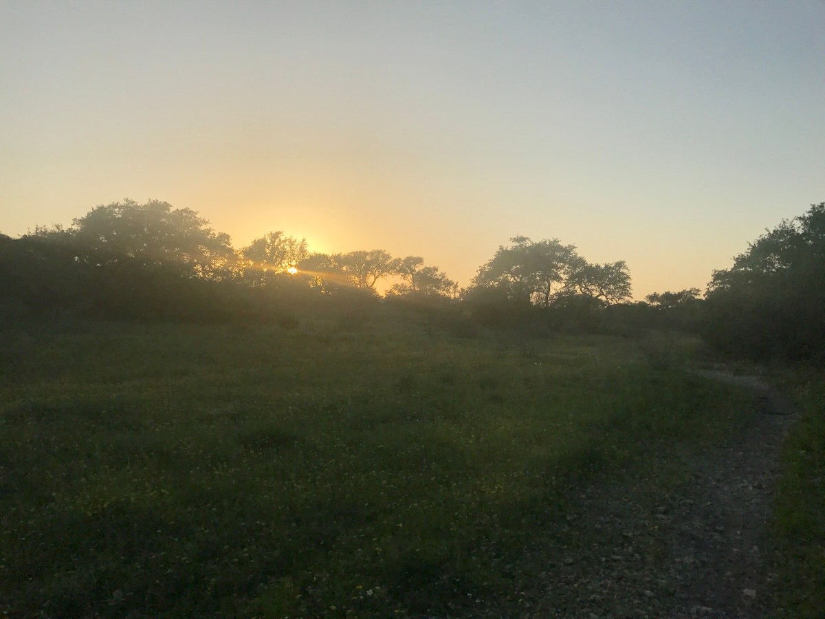
Today’s run was great. About a mile in, as I was mulling over life events and major decisions, I crossed paths with two people on a tandem mountain bike, and they warned me about a rattlesnake they had seen. I tried to be chill about it at first, but called out as they rode off, “ON THE TRAIL?”

“YES!” they shouted back.

Yikes. I came across a freakin’ alligator on a trail not too long ago, and that was startling, but this gave me the willies. The trail had a decent amount of overgrown single track, and I didn’t feel comfortable letting myself zone out with my thoughts for the rest of the run, so I didn’t. I paid heavy attention to every step, taking in as much detail of the ground as I could with each move forward. I never saw the snake, but for my efforts in avoiding it, I caught sight of a bunny that held still as long as I needed to snap a picture, and as I turned to resume the run, three deer bounded right in front of me! If I hadn’t been looking for the snake, I wouldn’t have seen the bunny, and if I hadn’t stopped for the bunny, I might have missed the deer.

I have two more days of running to do here, and I’m really looking forward to them. Whether I see something new or think something new, its all good. Lord Henry was right, sometimes we need to get away from all the input, and other times its great to get out of ourselves.

THE RUN:

Slaughter Creek Preserve Trail


Trail Runs in Houston, TX: Cullinan Park and Brazos Bend State Park

This past week I explored two new places to trail run in the Houston area. The first, Cullinan Park in Sugarland, was recommended to me by a friend, which is great because I was unaware the park existed, and the second, Brazos Bend State Park is very well known, at least in the area.


CULLINAN PARK

My sister and I headed out to Cullinan on Sunday. I had looked at park online and from my friend’s report gathered I would probably be running around 3 miles. Arriving there, I realized there was a main trail consisting of a 1.5 mile loop, but there were off-shoot trails and connectors, so the total amount of mileage was a little over 3 miles. One of the trails, the red trail, appears to end on the map, but it actually continues through the woods and around the lake, and I recommend going the whole way, which will bring your right around to the parking lot.


This is a great park for people looking to get some easy, fun, trail running in. It’s in Houston, so its flat. But it offers a variety of scenery; especially considering the small area the park takes up. It’s not far out of the way of anything, being just a few miles from I-69, and parking was free. The only bathroom available was a porto-potty, so if that turns you off, just go before you arrive and you should be fine for such a short run. We went on a Sunday with pretty pleasant weather, and the park was not crowded. Most of the visitors stayed near the parking lot, as there are viewing decks to see wildlife- we saw baby alligators!


As you can see from the map below, these trails have names, but I appreciate the simplicity of their color-coding on the map and will use that for reference. When you get out there, you will find colored bands on trees for the individual trailheads.


IMG_0863.jpg

From the parking lot, we went to the main trailhead, and took the green route to the first off-shoot of the blue route, and from there took the red route. On the red route we came across a pretty interesting scene, but I wont give away what that was here! As I said, the map shows the red route ending, but we were able to make it around the lake and back to the parking lot, still on trail, where we started at the main (green) trailhead again, this time taking an immediate left to go in the other direction on the green trail. We followed that around to the lavender trail. This was the least interesting trail in the park, to me. If you want to get the mileage, great, but if you’re looking to cut something, it’s just wide and flat, and dead-ends at a canal with a view of the road. We went back towards the green trail on the lavender trail, I took a little side jaunt to check out the turquoise trail, which had a pretty enchanting vibe, before we headed back to the parking lot on the green trail.


It was a fun run. Aside from the lavender trail, you’re looking at mostly single track or close to it. There’s plenty of shade, and for its size and location, I didn’t feel like I was running anywhere near a city (save a few glimpses of neighborhoods on the red route). There were some tricky areas to navigate, If you want to get to the other side of the green trail from the trailhead, take the second or third crossover, the first took us off the path as we had to navigate around some muck and water, but you’ll see that from the main path. The only path we didn’t take was the yellow, and as I ran ahead and doubled back to join up with my sister a few times, I was able to turn 3.3 miles of trail into 4 easily, and it’s worth repeating that the scenery changes often, and it’s all very pretty.


BRAZOS BEND

The second trail run of the week took me out to Brazos Bend State Park, southwest of Houston. It’s a very well-known park in the area, the upkeep and amenities are fantastic, and the staff is friendly and helpful. When I arrived, I purchased an annual Texas State Parks pass ($70), and the ranger assisting me was able to recommend trails to run on, as well as which ones to avoid because they were still recovering from heavy rain.

The website claims 37 miles of hiking trails in the park, which I believe includes the paved areas as well, and I covered around 6 or so. I’ll share what I did that day and update the blog once I explore and find out more. I’m including an image of the map the ranger gave me, with his recommendations highlighted in yellow, and what I actually ran in blue marker. (I ran out a bit on some other trails to get a look around, which is how I covered 6 miles). The black “X” marks trails I was to avoid.

IMG_0862.jpg


I parked behind Elm Lake, right at the turn-around, and took the Elm Lake Loop Trail to the Spillway Trail. If you didn’t know, Brazos Bend is known for its wild alligator population, and I was not disappointed. Not one mile into my run, I saw two from a bridge on the Spillway Trail, then came across one right on the path. I wasn’t sure what to do, as cautionary signage insisted on giving the animals a birth of 30 feet, which was impossible with water on both sides of the trail. I don’t know how fast alligators are, but I remembered a friend saying he just ran by them in the park all the time. I started to approach, and at that moment the formerly still reptile started moving its legs and opening its mouth at me, and I was done. I had planned to take the Spillway Trail around 40 Acre Lake, but I turned back and made my way back to the Elm Lake Trail.


When I came to the Pliant Slough trail, I took that. The ranger hadn’t mentioned it as good or something to avoid, and I’m glad I ran it. The ground was super springy, and I was reminded how much better it feels to be off of concrete. The trail was only a mile long, and I was loving the stretch so much that I was tempted to run it twice, but instead took the trail back around to the observatory, where I made my way back around Elm Lake once again. When I got near my car, I ran past to the Horseshoe Lake Loop, trying to get to at least 6 miles.


I didn’t even cover a third of the mileage in the park, but of what I did see, none of it was single track, and it was all very flat. Still, it’s a great place to get in long runs off of the concrete, if the pretty scenery doesn’t interest you, watching for alligators will keep you from getting bored!

Trail Run in Scotland: Great Glen Way, Part 2

Day 2: Invergarry to Invermoriston, 16 miles


The second day of my Great Glen Way run, I woke up before 5 am. I didn’t need to get up till 8:30 at the earliest, so I tried to go back to sleep. I think I dozed a little, but I mostly day-dreamed and game planned for a life I wanted to spend traveling, running, and writing. I had breakfast in a sunlit dining room while I chatted with my hosts at the Glen Albyn Lodge. I had requested a packed lunch the night before, and was presented with a sandwich, crisps (chips), and sweets for 6 pounds before I left.


I caught the Great Glen Way a kilometer or so down the road from the B & B. It started off as a nice winding playground of a trail, with small climbs and descents- more fun than work. Not even considering digestion cramps from breakfast, I ran alongside Loch Oich until the trail met the road again, at a town called Aberchalder. There, I stood still and stared at a boat as it went through the lock, heading to Loch Oich from the north. I understood the concept of locks, but hadn’t witnessed it in person before. It started to rain a bit through the process and I took off.


The path then followed the Caledonian Canal once again. The main excitement of that stretch came from the frequent costume changes I went through. The weather would change suddenly and drastically, from cold rain to sunny, partly cloudy skies. I was constantly putting on or removing my jacket and gloves, and putting away my camera or grabbing it from my pack to snap the incredibly blue sky when the rain would let up over the canal. After 5 miles, I was in Fort Augustus.

Fort Augustus was downright bustling after the lonely stretches I had just completed solo. There were more boats going through the locks there, and many people were out as well, despite the temperamental weather. It was the largest village I had passed through since leaving Fort William. There was a visitor’s center, eateries with enticing menus, local craft shops and whiskey tasting spots. My drop bag was left for me at the Lovat Arms Hotel, which I located without a problem. I settled in with my packed lunch and the goodies in my drop bag in the living room area of the hotel, in front of a lit fire. It had started to rain a little more steadily at that point, and I relaxed on a comfortable couch, perusing my photos so far and the map of the route ahead. Once finished, I went to the visitors’ center and purchased a magnet featuring the Caledonian Canal. Magnets are my go-to as souvenirs, because they are small, plus I’m always in my fridge and thus get constant reminders of my travels.

As I went over the map while I was nestled into the Lovat Arms, I was trying to make a decision- high route or low route? From Fort Augustus, I could climb or not climb, and still arrive at the same point. I knew about the two “high routes” on the Great Glen Way, and one started after leaving Fort Augustus. I had told myself I wouldn’t do the high route- the mileage I was doing was enough. I was tired, and my muscles and tendons were too unpredictable. However, when I got to the fork in the road, I chose the high route. It’s a cool feeling when “what you would do” kicks the ass of “what you did do”.

Once I was through the main ascent, the terrain alone was surreal. The forest I had been climbing through gave way to barren, rolling hills that had once held trees that had since been farmed. I made sure to keep looking south every now and then even though I was running north, because the southern views were more interesting. I came across a couple trekking together, and offered to take their picture, as I saw they were taking turns snapping each other. They were heading north, but going for the southern views as well.

The written guide claimed I’d be running 20 miles that day, but since I was picked up in Laggan at the Eagle Inn (see previous post) and driven to Invergarry, I actually wound up running more like 16. I finished in Invermoriston. It was another great place to end a day of running- I arrived before check in, so I went to a coffee shop for a snack and free wi-fi.  I also visited this awesome craft shop, where I purchased leather wristbands that would have probably been at least $30 in the states, but were going for 3 to 4 pounds each.

IMG_7792

My B & B that night was the Bracarina House, but I had dinner at the Glenmoriston Arms, the hotel next door. I had booked my meal there before even leaving for my trip, as I was advised that it was the only place to get dinner in town and it could fill up quickly. I had a steak. It was delicious, and I devoured it like a hungry raccoon. I met two older gentlemen who were also walking the way. I would find them a few more times. Martyn & Dic were from Wales, a few decades later in life than myself, and did hikes and walks most weekends. They trekked mostly local to Wales, but with trips like the Great Glen Way sprinkled in. They claimed weekend averages of 14 miles. What a life! The last time I met up with them, I was sitting on a train on the way back to Edinburgh, and they happened to be across the aisle- at that point, it was the fourth time we crossed paths. I had taken this running trip to see what I could do, and these dudes showed me.

%d bloggers like this: