
I have returned from my first running themed vacation! It was in the Scottish Highlands, on the Great Glen Way, a 77 mile trail that runs along the Caledonian Canal and its lochs, including Loch Ness. It was an incredibly fun and gratifying experience…
Prelude: Edinburgh to Fort William
I landed in Edinburgh a few mornings before I was to begin the run. I wanted to give myself a cushion for both late flights and jet-lag adjustment. My right leg was threatening tendonitis, but I was trying not to be apprehensive about the run ahead. The day after I landed in Edinburgh, I walked by a hotel offering a special on massages, and I signed up on the spot. It was one of the best massages of my life, because it saved the running trip, but I wouldn’t find that out for a few more days. I did some sightseeing in Edinburgh, including a very gentle 2-mile jog around the University of Edinburgh campus the day after the massage.
My absolute favorite thing that I did while in Edinburgh was luck into a tour of Greyfriars Kirkyard. At breakfast with a few young women from my hostel, I mentioned that I had heard it was where J.K. Rowling drew inspiration for many familiar names in the Harry Potter series. Their interest confirmed, we all set off for the kirkyard (cemetery), and were there about 15 minutes before we were approached by an older gentleman who offered us a tour, donation only. It was one of THE BEST tours I’ve ever been on. It included and pointed out information from the books, but interwove the history and current events of the cemetery, Edinburgh, and Scotland. I learned so much from our guide and am glad we didn’t just poke around on our own.
Mind and body ready to soak up more of Scotland, I took a train from Edinburgh to Fort William, where the Great Glen Way begins. My itinerary from Macs Adventures had all the details of getting around down for me. I was staying in B & B’s each night during the run. In my latest travels preceding this trip, I’d either used Air B & B or stayed in a hotel. I’d opted to stay in a hostel in Edinburgh to revisit my youth- but I will probably not stay in a hostel again if I can avoid it. Little things pop up now and then to remind me I’m no longer in my 20’s, and sleeping in a top bunk and showering in a communal bathroom are just a few aspects I find barely tolerable. At my first B & B, Myrtle Bank Guest House, I had space to spread out, relax, and prep for my run. I went back into town to grab dinner, a few short sleeve shirts because the weather was warmer than I expected, and some sustenance for the drop bags the company was going to stage for me on the longer runs.
I liked Fort William. People were finishing their walks from either the West Highland Way (another trail) or the Great Glen Way, while others were preparing or coming back from climbing Ben Nevis- the UK’s highest mountain. I would love to go back both to spend more time in the town and go up that mountain. I met some older dudes at dinner that were climbing Nevis the next day, and drinking heavily. I deduced I could handle the hike.
Before I went to bed that night, I looked out the skylight, and I was dazzled by the nightscape. I always get stunned when I see how many more stars there are than are visible from my backyard in Los Angeles.


Day One: Fort William to Laggan, 23 miles
The next morning I woke up and had breakfast, left my larger luggage and drop bags at reception for transport, and set off through town for the trailhead. I decided to walk the first two miles, of the total of 23, to be done that day. I had to digest my breakfast, and also wanted to give my legs a chance to warm up. I was praying and praying that once I started to run, I would find that the tendonitis in my knee had let up. I don’t know if it was the praying, the massage, or both, but something gave and after walking for a couple of miles, I tentatively started to jog and found that everything was feeling fine!
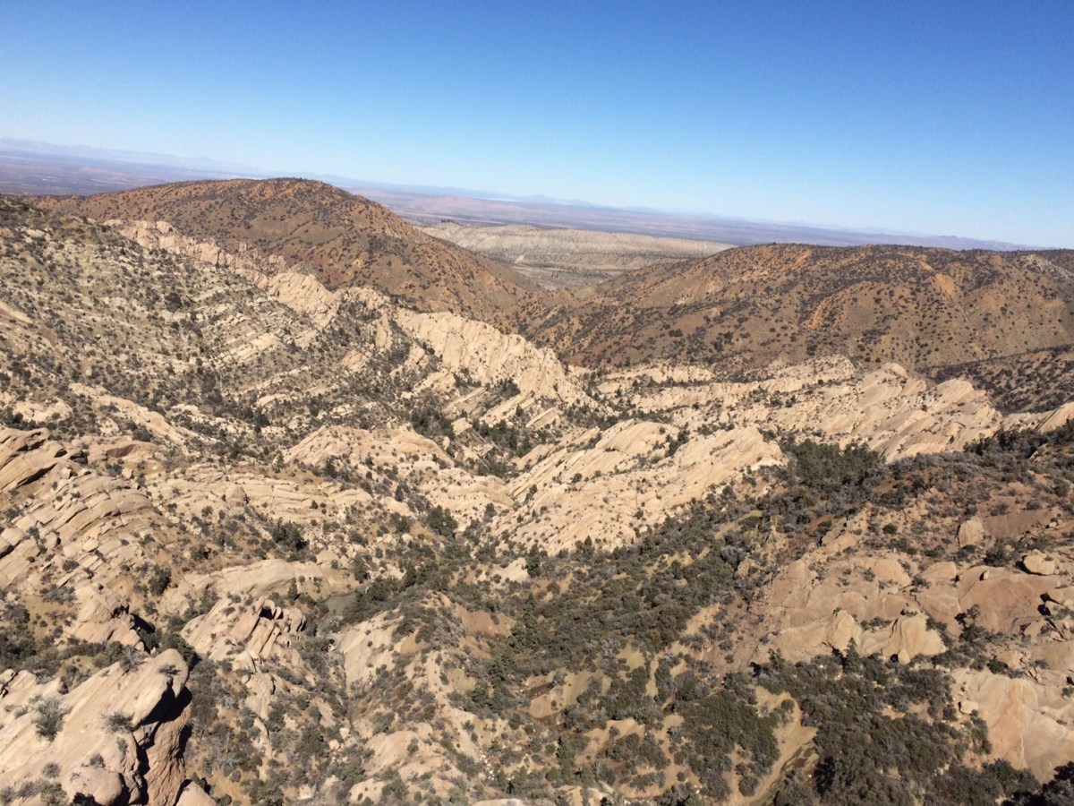
The trail leaving Fort William winds though a couple different settings. I was in the woods for a bit, I walked though neighborhoods, along the road, and saw sheep. The neatest part about it is the view of Ben Nevis. The rest was honestly a little dull. After a few miles the trail starts following the Caledonian Canal, which runs from northern to southern Scotland. I saw my first set of locks, which carry the boats between the northern lower bodies of water and the higher ones in the south. There are several along the canal, between each of the lakes (Got that? It goes loch-lock-loch) There weren’t any boats going through, but it was a quiet and pretty setting nonetheless. I passed local exercisers, and a few gentlemen that were walking the trail with packs. The next twelve miles took me along the canal, on a paved path, to Gairlochy, where the adventure really started.
In the small town of Gairlochy I was supposed to pick up my first drop bag from a B & B, but either I had the wrong place or someone hadn’t timed things right, because no one was there. I called Macs Adventures to locate it, and they lead me over the phone right to the place, but no one answered the door when I rang. It wasn’t a big deal though. My Osprey pack holds 1.5 liters of water, and I wasn’t even halfway through. I can drain that thing in two hours running around Southern California, but here the weather was moist and cool, and I was feeling great, so I decided I could make it to my next stop just fine. In fact, I lucked into pretty good weather for most of the run. It was cold at times, and there was some rain, but I had prepared myself for much less temperate conditions.
Upon leaving Gairlochy, I turned off the road and found myself on this beautiful, winding single-track through the woods. The next ten miles were enchanting. As the trail came upon the water of Loch Lochy, I thought of fairy tale kingdoms. I hope “Loch Lochy” translates roughly to “Lake Lakey”, but I haven’t concluded my research on this subject yet. I found myself on a road, passing by country houses, before turning onto a path that lead me through the woods and along the lake. I found a sign describing forest fauna and flora, and “holly” was featured! I continued on, passing by a group of five middle-aged men and a younger couple, before reaching farms and seeing my stopping point, The Eagle Inn, a bar/restaurant built into a boat on the water.
Less than a mile from the Eagle Inn, my progress was interrupted by farm animals. A lamb was fenced in, and there was a sheep right on the path, trying to encourage the lamb to come through. It was pitiful- the lamb kept sticking its head through the wire of the fence, but that was all that could fit. They were baa-ing at each other. The sheep stared at me as I approached. I know more about outer space than I know about sheep, and I didn’t want to entice an attack, so I patiently waited, then decided to edge forward, hoping the sheep would back off. It did, at least enough to where I could bolt through. I had read not to bother any of the farm animals along the trail, and in addition, thirty-two years on planet Earth has taught me not to mess with mothers and their young.
The Eagle Inn was a perfectly lovely way to end my twenty three mile run. Despite hitting my head on the top of the low doorway each time I entered and exited, I enjoyed myself. The two groups of people (5 men & couple) that I passed caught up with me there, and we talked about our journeys. One of the men put my blog in his phone for a family member, which I really appreciated. They were surprised I had started in Fort William that morning, as walkers tend to do Fort William to Gairlochy in one day and Gairlochy to Laggan the next. I called the proprietors of my next B & B, Glen Albyn Lodge in Invergarry, to let them know I had arrived, and waited for my pickup. I could have done another three miles from the Eagle Inn straight to the lodge, but I was beat.
That night I ate at the Invergarry Hotel. It was half a mile away from the B & B and walking there felt like a death march. Dennis, one of the owners of the B & B, recommended the haggis, but I couldn’t stomach that. I think I had a burger. After dinner, I went straight to bed; I was asleep before 9:30pm, which lead to me being awake at 4:45 the next morning…


I don’t want this post to be too long, so I’ll put the next two days of running up later!
Recap/Details of Run- I recommend all of these things!
- Trail: Great Glen Way
- Tour Company: Macs Adventure
- Lodging
- Fort William: Myrtle Bank Guest House
- Invergarry: Glen Albyn Lodge
- Gear:
- Shoes: Nike Wildhorse
- Pack: Osprey Rev 6
- Rain Jacket: Patagonia Storm Racer
- Watch: Garmin 620


You must be logged in to post a comment.